جلد سخت سیاه و سفید
Product details
- Publisher : Packt Publishing (April 29, 2022)
- Language : English
- Paperback : 586 pages
- ISBN-10 : 1803241667
- ISBN-13 : 978-1803241661
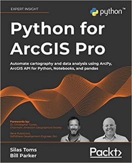
کتاب Python for ArcGIS Pro: Automate cartography and data analysis using ArcPy, ArcGIS API for Python, Notebooks, and pandas
Extend your ArcGIS expertise by unlocking the world of Python programming. A fully hands-on guide that takes you through exercise after exercise using real data and real problems.
Key Features
- Learn the core components of the two Python modules for ArcGIS: ArcPy and ArcGIS API for Python
- Use ArcPy, pandas, NumPy, and ArcGIS in ArcGIS Pro Notebooks to manage and analyze geospatial data at scale
- Integrate with ArcGIS Online using Python to publish and manage data
Book Description
Integrating Python into your day-to-day ArcGIS work is highly recommended when dealing with large amounts of geospatial data. Python for ArcGIS Pro aims to help you get your work done faster, with greater repeatability and higher confidence in your results.
Starting from programming basics and building in complexity, two experienced ArcGIS professionals-turned-Python programmers teach you how to incorporate scripting at each step: automating the production of maps for print, managing data between ArcGIS Pro and ArcGIS Online, creating custom script tools for sharing, and then running data analysis and visualization on top of the ArcGIS geospatial library, all using Python.
You'll use ArcGIS Pro Notebooks to explore and analyze geospatial data, and write data engineering scripts to manage ongoing data processing and data transfers. This exercise-based book also includes three rich real-world case studies, giving you an opportunity to apply and extend the concepts you studied earlier.
Irrespective of your expertise level with Esri software or the Python language, you'll benefit from this book's hands-on approach, which takes you through the major uses of Python for ArcGIS Pro to boost your ArcGIS productivity.
What you will learn
- Automate map production to make and edit maps at scale, cutting down on repetitive tasks
- Publish map layer data to ArcGIS Online
- Automate data updates using the ArcPy Data Access module and cursors
- Turn your scripts into script tools for ArcGIS Pro
- Learn how to manage data on ArcGIS Online
- Query, edit, and append to feature layers and create symbology with renderers and colorizers
- Apply pandas and NumPy to raster and vector analysis
- Learn new tricks to manage data for entire cities or large companies
Who this book is for
This book is ideal for anyone looking to add Python to their ArcGIS Pro workflows, even if you have no prior experience with programming. This includes ArcGIS professionals, intermediate ArcGIS Pro users, ArcGIS Pro power users, students, and people who want to move from being a GIS Technician to GIS Analyst; GIS Analyst to GIS Programmer; or GIS Developer/Programmer to a GIS Architect. Basic familiarity with geospatial/GIS syntax, ArcGIS, and data science (pandas) is helpful, though not necessary.
Table of Contents
- Introduction to Python for GIS
- Basics of ArcPy
- ArcGIS API for Python
- The Data Access Module and Cursors
- Publishing to ArcGIS Online
- ArcToolbox Script Tools
- Automated Map Production
- Pandas, Data Frames, and Vector Data
- Raster Analysis with Python
- Geospatial Data Processing with NumPy
- Case Study: ArcGIS Online Administration and Data Management
- Case Study: Advanced Map Automation
- Case Study: Predicting Crop Yields
منابع کتاب کتاب Python for ArcGIS Pro: Automate cartography and data analysis using ArcPy, ArcGIS API for Python, Notebooks, and pandas
با باز کردن قفل دنیای برنامه نویسی پایتون، تخصص ArcGIS خود را گسترش دهید. یک راهنمای کاملاً عملی که شما را با استفاده از دادههای واقعی و مشکلات واقعی، بعد از تمرین ورزش میکند.
ویژگی های کلیدی
- اجزای اصلی دو ماژول پایتون برای ArcGIS را یاد بگیرید: ArcPy و ArcGIS API برای Python
- از ArcPy، پانداها، NumPy و ArcGIS در نوت بوک های ArcGIS Pro برای مدیریت و تجزیه و تحلیل داده های مکانی در مقیاس استفاده کنید.
- ادغام با ArcGIS Online با استفاده از پایتون برای انتشار و مدیریت داده ها
توضیحات کتاب
ادغام Python در کارهای روزمره ArcGIS در هنگام برخورد با مقادیر زیادی از داده های مکانی بسیار توصیه می شود. Python for ArcGIS Pro قصد دارد به شما کمک کند کار خود را سریعتر انجام دهید، با تکرارپذیری بیشتر و اطمینان بیشتر در نتایج خود.
با شروع از مبانی برنامه نویسی و ایجاد پیچیدگی، دو متخصص با تجربه ArcGIS که به پایتون تبدیل شده اند، به شما یاد می دهند که چگونه برنامه نویسی را در هر مرحله ترکیب کنید: تولید خودکار نقشه ها برای چاپ، مدیریت داده ها بین ArcGIS Pro و ArcGIS Online، ایجاد ابزارهای اسکریپت سفارشی برای به اشتراک گذاری، و سپس اجرای تجزیه و تحلیل و تجسم داده ها در بالای کتابخانه جغرافیایی ArcGIS، همه با استفاده از پایتون.
شما از نوت بوک های ArcGIS Pro برای کاوش و تجزیه و تحلیل داده های مکانی و نوشتن اسکریپت های مهندسی داده برای مدیریت پردازش و انتقال داده های جاری استفاده خواهید کرد. این کتاب مبتنی بر تمرین همچنین شامل سه مطالعه موردی غنی در دنیای واقعی است که به شما فرصتی میدهد تا مفاهیمی را که قبلاً مطالعه کردهاید به کار ببرید و گسترش دهید.
صرف نظر از سطح تخصص خود در نرم افزار Esri یا زبان Python، از رویکرد عملی این کتاب بهره مند خواهید شد، که شما را از طریق کاربردهای اصلی Python برای ArcGIS Pro برای افزایش بهره وری ArcGIS خود راهنمایی می کند.
آنچه خواهید آموخت
- تولید نقشه را خودکار کنید تا نقشه ها را در مقیاس بسازید و ویرایش کنید و کارهای تکراری را کاهش دهید
- داده های لایه نقشه را در ArcGIS Online منتشر کنید
- به روز رسانی داده ها را با استفاده از ماژول ArcPy Data Access و نشانگرها به صورت خودکار انجام دهید
- اسکریپت های خود را به ابزارهای اسکریپت برای ArcGIS Pro تبدیل کنید
- با نحوه مدیریت داده ها در ArcGIS Online آشنا شوید
- پرس و جو، ویرایش، و الحاق به لایه های ویژگی و ایجاد نمادشناسی با رندرها و رنگ آمیزی ها
- پانداها و NumPy را در تحلیل شطرنجی و برداری اعمال کنید
- ترفندهای جدیدی برای مدیریت داده ها برای کل شهرها یا شرکت های بزرگ بیاموزید
این کتاب برای چه کسی است
این کتاب برای هر کسی که به دنبال اضافه کردن پایتون به گردشهای کاری ArcGIS Pro خود است، ایدهآل است، حتی اگر تجربه قبلی با برنامهنویسی نداشته باشید. این شامل متخصصان ArcGIS، کاربران متوسط ArcGIS Pro، کاربران قدرتمند ArcGIS Pro، دانشجویان و افرادی است که میخواهند از یک تکنسین GIS به تحلیلگر GIS حرکت کنند. تحلیلگر GIS تا برنامه نویس GIS; یا توسعه دهنده/برنامه نویس GIS به یک معمار GIS. آشنایی اولیه با نحو geospatial/GIS، ArcGIS و علم داده (pandas) مفید است، هرچند ضروری نیست.
فهرست مطالب
- مقدمه ای بر پایتون برای GIS
- مبانی ArcPy
- ArcGIS API برای پایتون
- ماژول دسترسی به داده و نشانگرها
- انتشار در ArcGIS آنلاین
- ابزارهای اسکریپت ArcToolbox
- تولید نقشه خودکار
- پانداها، قاب های داده و داده های برداری
- تجزیه و تحلیل شطرنجی با پایتون
- پردازش داده های مکانی با NumPy
- مطالعه موردی: مدیریت آنلاین و مدیریت داده ArcGIS
- مطالعه موردی: اتوماسیون نقشه پیشرفته
- مطالعه موردی: پیش بینی بازده محصول


ارسال نظر درباره کتاب Python for ArcGIS Pro: Automate cartography and data analysis using ArcPy, ArcGIS API for Python, Notebooks, and pandas