جلد سخت سیاه و سفید
Product details
- Publisher : CRC Press; 1st edition (February 4, 2022)
- Language : English
- Hardcover : 400 pages
- ISBN-10 : 1032015039
- ISBN-13 : 978-1032015033
کتاب Surveying with Geomatics and R
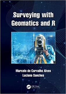
Surveying with Geomatics and R
This book explains basic concepts of surveying science and techniques with geomatics using R software and R packages. It engages students in learning about surveying through real field examples and using differing degrees of complexity while exploring surveying problems based on field observations and advanced geospatial technology. It includes a wide range of case studies as hands-on and self-paced tutorials along with detailed computer programming routines that are linked to the theories and applications explained in each chapter. This innovative textbook also teaches how to explore other possibilities of using geomatics in geocomputation, remote sensing, geography and cartography courses focused on surveying tasks.
Features include:
- Provides modern surveying practices with free software algorithm and R toolset for active learning
- Includes case studies from different geographical areas using arbitrary and international cartographic reference systems
- Enables and demonstrates the integration of traditional geomatics with modern geospatial big data technologies
- Explains data standards, equipment used, possible analyses and the importance of error evaluation for scientific surveying
- Discusses different scales of landscapes and brings together the experiences of leading experts in the field
منابع کتاب کتاب Surveying with Geomatics and R
نقشه برداری با ژئوماتیک و آر
این کتاب مفاهیم اولیه علم و تکنیک های نقشه برداری با ژئوماتیک را با استفاده از نرم افزار R و بسته های R توضیح می دهد. این دانش آموزان را در یادگیری در مورد نقشه برداری از طریق مثال های میدانی واقعی و استفاده از درجات مختلف پیچیدگی در حین کاوش در مسائل نقشه برداری بر اساس مشاهدات میدانی و فناوری پیشرفته جغرافیایی مشارکت می دهد. این شامل طیف گستردهای از مطالعات موردی بهعنوان آموزشهای عملی و خودگام همراه با روالهای برنامهنویسی رایانهای است که به نظریهها و کاربردهایی که در هر فصل توضیح داده شده است، مرتبط هستند. این کتاب درسی ابتکاری همچنین نحوه کشف سایر امکانات استفاده از ژئوماتیک در دوره های محاسبات جغرافیایی، سنجش از دور، جغرافیا و نقشه برداری را با تمرکز بر وظایف نقشه برداری می آموزد.
امکانات عبارتند از:
- شیوه های نقشه برداری مدرن را با الگوریتم نرم افزار رایگان و مجموعه ابزار R برای یادگیری فعال ارائه می دهد
- شامل مطالعات موردی از مناطق مختلف جغرافیایی با استفاده از سیستم های مرجع نقشه برداری دلخواه و بین المللی است
- ادغام ژئوماتیک سنتی با فناوریهای دادههای بزرگ جغرافیایی مدرن را فعال و نشان میدهد
- استانداردهای داده ها، تجهیزات مورد استفاده، تجزیه و تحلیل های احتمالی و اهمیت ارزیابی خطا برای بررسی علمی را توضیح می دهد
- مقیاس های مختلف مناظر را مورد بحث قرار می دهد و تجربیات کارشناسان برجسته در این زمینه را گرد هم می آورد










ارسال نظر درباره کتاب Surveying with Geomatics and R